Something new is emerging from Newcastle, the former steel and coal city. It’s steadily reinventing itself as a Smart City. Sensors everywhere, pilot projects sprouting up left and right — I should write about that in more detail one of these days.
Climate change has also arrived in plain sight here in Newcastle and neighbouring Lake Macquarie: the sea is rising, claiming more land with every storm season, and the storms themselves are getting fiercer. It used to be a status symbol to own a house right on the waterfront. Now there’s nothing but sympathy when you see desperate people on the telly, standing on a vast terrace directly above the churning ocean. The thin stilts are about to buckle, and the luxury house begins its slow slide towards the edge — then lurches forward in one decisive heave and tips into the water.
Australia has a lot of land and not many people. Even the most beautiful beaches around Newcastle are never packed shoulder-to-shoulder like Rimini. Sydney is a different story, of course. But that also means: how do you keep tabs on all those beaches, and how do you track how they change over the years?
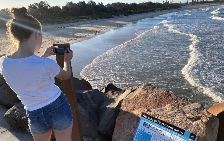
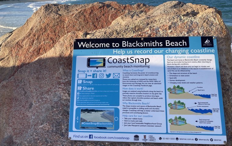
Enter the CoastalSnap project. At many beaches around Newcastle, you’ll find a special photo opportunity: steel cradles have been set up where you can rest your phone and snap a photo. The picture captures the beach from a fixed angle. Next to the cradle stands a sign with a hashtag — in this case, #CoastalSnapBlacksmiths. Upload it to Instagram or whichever social channel you like, and over time the changes become visible. Citizen science, crowdsourced.
So from here on, I’ll be taking photos at these beaches whenever I get the chance, tagged with the relevant hashtag. This page lists all the beaches with their designated snap spots. My goal: photograph every single one. Stay tuned.
First published in German at reinergaertner.de, where I’ve been at it since 1997. AI did the heavy lifting on the translation. I did the heavy squinting at the result.